Wireless Wonder: A History of Radar Use for Weather Operations Part I
- By AMS Staff
- Jul 31, 2023
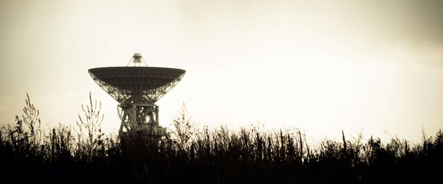
Photo by Marat Gilyadzinov
The earliest origins of radar meteorology are difficult to uncover. The secrecy surrounding radar in World War II delayed reporting about technological breakthroughs until 1945 and later. But as far as can be determined, radio-location technology was fairly similar across different nations at the outbreak of the war. British work was slightly more advanced, largely due to the efforts of Sir Robert A. Watson-Watt. A Scottish physicist and meteorologist, Watson-Watt was a fellow of the Royal Meteorological Society by 1915, published a paper on radio waves created by lightning in 1922, and delivered the Symons Memorial Lecture in 1929 on ‘‘Weather and Wireless.’’
In the first of a number of positions he held in the British government from 1915 to 1952, Watson-Watt developed crude radio-location, direction-finding devices that could locate thunderstorms based on the electromagnetic pulses or sferics they emitted. As head of the radio department of the National Physical Laboratory, he later turned his efforts to locating military targets via radio by measuring the distance between the transmitter and the targets. In 1935, he started investigating the use of electromagnetic waves to locate aircraft. This work influenced the design of Britain’s (and the world’s) first operational radar system, the Chain Home radars. That system was in place before the Battle of Britain and is credited with being one of the most important factors enabling the outnumbered Royal Air Force to turn back the Luftwaffe over the skies of England early in the war.
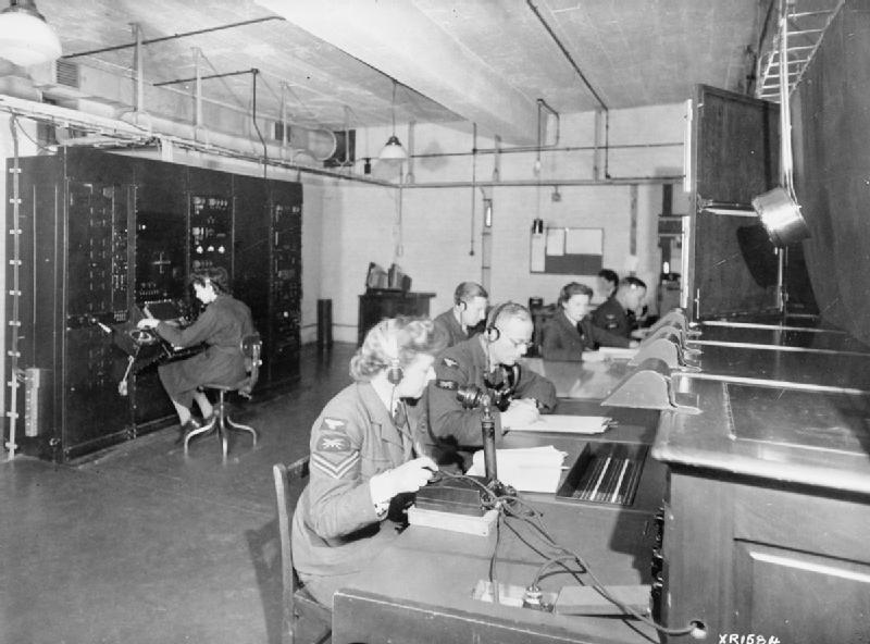
A photo of the East Coast Chain Home radar station
Beginning in July 1940, a radar of 10-cm wavelength was operated at the General Electric Corporation Research Laboratory in Wembley, England, where Dr. J. W. Ryde worked (Doviak and Zrnic´ 1993). It is likely that the first weather echo was seen on this radar or another like it in England, probably in late 1940 or possibly as late as February 1941. Perhaps to explain these weather echoes, which might interfere with detection of aircraft, Ryde was asked to investigate the attenuation and backscattering properties of clouds and rain (Probert-Jones 1990). Ryde reported this wartime work in the open literature later (Ryde 1946).
Similar studies conducted from 1942 to 1944 at the Massachusetts Institute of Technology’s (MIT) Radiation Laboratory (the Rad Lab, as it was called), largely by Bent (1946), showed that weather could be detected on certain types of radars out to ranges of 150 mi at 3- and 10-cm wavelengths. During the first half of 1943, Major J. Fletcher of the Army Air Forces Weather Service worked at the Rad Lab and, about a year later, established a program for use of weather radar within the Army Air Forces Weather Service (Wexler and Swingle 1947).
Early efforts to use radar on the ground for operational meteorological purposes included repurposing radars installed for nonweather missions, such as bombing, navigation, gunnery, and aircraft control, to make weather observations. There were, however, also some radars dedicated to or converted for use principally in operational weather support, such as the radars in weather reconnaissance aircraft and ground-based radars at weather stations.
First radar networks used for weather surveillance
The first radar network used for weather surveillance was formed in Panama in April 1944, when weather observing and reporting began at two Harbor Defense Cristobal installations, facing the Atlantic Ocean (Best 1973). In May 1944, the network was augmented by using two higher-power aircraft-warning radars on Taboga Island, near Balboa, on the Pacific side and Fort Sherman on the Atlantic. The network took radar weather observations regularly, encoded them in a special radar reporting code, and transmitted them on Teletype communications. These reports were called RAREPs (radar reports).
The operations and research activities of the Panama radar network were managed by Lieutenant Myron G. H. ‘‘Herb’’ Ligda, who was assigned in February 1944 as the 6th Weather Region’s Radar Weather Officer. In addition to weather observations, the network also studied relationships between echo ‘‘intensity’’ and surface visibility, differences between echoes over land and those over water, effects of the land–sea boundary on the movement of storms, the life cycle of convective storms, the effects of topography on storm movement and intensity, steering of storms by winds aloft, and detection of lightning by radar. They also completed an early radar climatology study, showing storm genesis regions and storm motion patterns in Panama. These investigations were conducted to improve the operational value of radar weather information to weather forecasters and their customers.
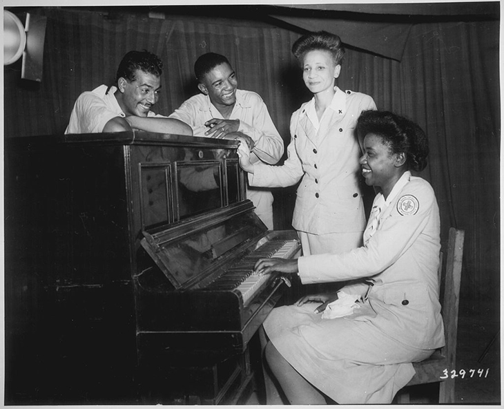
American soldiers and Red Cross workers enjoy a musical interlude while serving in Assam, India. Weather networks far from the U.S. helped propel weather research forward. Photo from the National Archives.
The second weather radar network (located in India) grew by unifying several operations at individual stations; that network used radars assigned principally to performing a weather surveillance function. In the summer of 1944, the 2nd Weather Reconnaissance Squadron’s B-25 aircraft were modified to carry the ‘‘radio set’’ AN/APQ-13, which was actually an X-band radar. The APQ-13 was developed jointly by the Bell Telephone Laboratories and the MIT Rad Lab. It was manufactured in great numbers by Western Electric, the manufacturing arm of the Bell System of the day. It was soon realized that the APQ-13, although originally designed as a bombing and navigation system for the B-17, B-24, B-25, and B-29, could readily detect weather. Thereafter, the APQ-13 was often used for storm detection.
In the fall of 1944, the second Weather Reconnaissance Squadron was deployed to a location near Calcutta, India. The aircraft radar worked well for storm detection, but it was difficult to use the heavily tasked weather reconnaissance aircraft and aircrews to stand watch for fast-moving, squall-line-type systems called nor’westers, for which operational warnings were desired. To meet this challenge, some APQ-13s were modified for ground use and installed on towers at weather stations. A single-station operation was tried successfully at Guskara, India. Radars were added at Chabua (June 1945) and Tezgoan (July 1945) near the Burma–India border to form a network covering the Assam Valley (Best 1973).
Radar weather observations were taken, recorded, and transmitted so that weather forecasters could synthesize storm data from multiple radars and brief aircrews flying in the ‘‘little hump’’ area of the China–Burma–India theater. Early use of radars individually and in networks for weather detection led to recognition of many basic features of storm structure and organization and of the value of the information for operational purposes (e.g., Maynard 1945). These wartime successes set the stage for postwar use of radar in meteorology and the accompanying growth of the new science of radar meteorology.
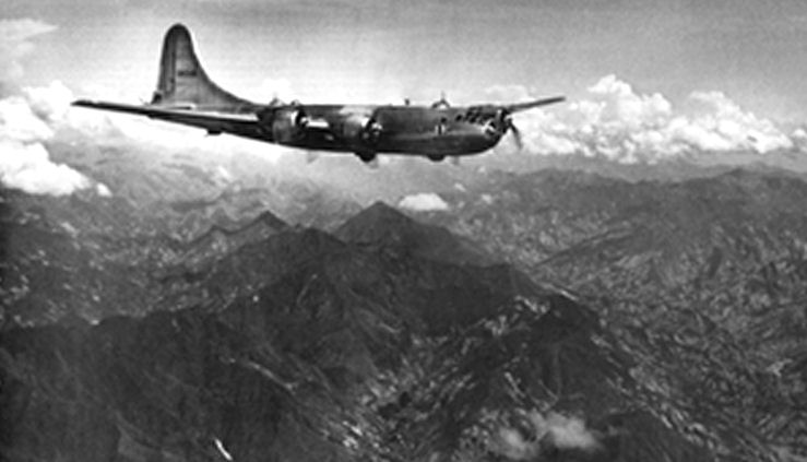
A B-29 crossing the "little hump" area
Post-war use of World War II radars at weather stations
In 1945, with development of the first true weather radar already under way, it was decided to test whether the widely available APQ-13, or an alternative, the AN/APS-10, would be more effective as an interim radar until the first weather radars could be deployed. Tests conducted in 1946 favored the APQ-13 (Miller 1947), which was then fielded as the first widely distributed ground-based radar used for storm detection. As is often the case with interim solutions, the APQ-13 continued in operation at many military bases until a follow-on weather radar was deployed in the 1960s. At the height of the APQ-13 program, AWS had more than 60 in operation at base and post weather stations worldwide. In October 1977, the last operational APQ-13 was removed from the Fort Sill, Oklahoma, post weather station. It was shipped to the Air Force Museum at Wright-Patterson Air Force Base (AFB), Ohio, which intended to display it in its original configuration as a bombing and navigation radar.
Meanwhile, the Weather Bureau, now called the National Weather Service (NWS), obtained 25 AN/APS-2F aircraft radars from the navy in 1946. These radars had S-band wavelengths, so attenuation by rain was almost entirely avoided; however, detection of light rain and snow was minimal due to system performance limitations. The radars were modified for meteorological use and put into operation at a rate of about five per year. The modifications were performed by the Weather Bureau, which called the modified APS-2F radars WSR-1s, -1As, -3s, and -4s. These early WSR-series systems were all basically the same radar; indicators and controls were the major differences between them.
 The first of these radars was commissioned at Washington, D.C. (Washington National Airport), on 12 March 1947. On 1 June 1947, the second such radar installed at a Weather Bureau office was commissioned at Wichita, Kansas, in the heart of ‘‘tornado alley.’’ In May 1949, reports from the Wichita radar were used to help guide an aircraft in distress and threatened by surrounding severe weather to an area free of severe thunderstorms, where it could be landed safely. Only three months after its commissioning in August 1947, the WSR-1 at Norfolk, Nebraska, had paid for itself in cost-avoidance actions taken by the Elkhorn Valley power system based on warnings of approaching electrical storms. These radars formed a part of the fledgling U.S. Basic Weather Radar Network.
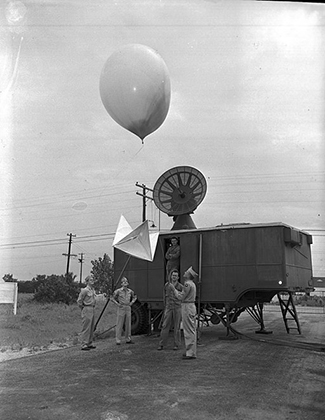
Weather activities continued to increase at army posts around the U.S. as seen in the photo to the left, where airmen launch weather balloons at Ft. Worth in 1947 (Courtesy, Fort Worth Star-Telegram Photograph Collection, Special Collections, The University of Texas at Arlington Library, Arlington, Texas) In the 1950s, the Weather Bureau added to the number of radars in service for storm detection purposes.
Acquisition, deployment, and operational use of the first weather radar
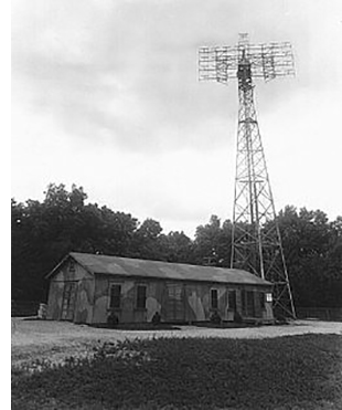 The AN/CPS-9 Storm Detection Radar was the first radar designed, developed, and deployed specifically for use by meteorologists as a weather observing and shortrange forecasting tool. In 1943–45, the Signal Corps Engineering Laboratories established a special radar weather section at Evans Signal Laboratory, Belmar, New Jersey. That group designed the CPS-9 to meet requirements developed by the Army Air Forces Weather Service. Some of those requirements placed limits on the size and cost of the system; for example, one requirement was that the radar should be able to travel in a single C-54 aircraft. Studies were conducted to determine the utility of wavelengths from 1 to 10 cm in detecting precipitation and the availability of microwave components at those wavelengths. It was found that, within the desired wavelength range, size, weight, and power components were available only in the X band. Developing components at other wavelengths would have protracted development of the radar for an additional two to three years. (Pictured is a radar tower at the Evans Signal Laboratory. Photo by First Lieutenant Harold Zahl)
Development models of the CPS-9 were produced by the Raytheon Manufacturing Company, Waltham, Massachusetts, the same company that would later produce the Weather Bureau’s WSR-57 radar and the DOT FAA’s Terminal Doppler Weather Radar. One of the development models was put in place at MIT’s Weather Radar Research Project (Austin and Geotis 1990). Other development copies received engineering testing at the Signal Laboratory and service testing by the Air Proving Ground of the U.S. Air Force.
The original plan for employment of the CPS-9 called for a closely spaced network of radars at almost every military weather station in the continental United States and a limited number at military bases overseas. In fact, 56 CPS-9s were produced for all services combined (Williams 1953), and less than 50 went into operational use in the Air Force; APQ-13s had to be kept in operation at facilities that did not receive a CPS-9. The first operational CPS-9 was installed at Maxwell AFB, Alabama, on 20 June 1954; that radar remained operational for 30 yr before finally being replaced on 14 July 1984 by a more modern radar, the AN/FPS-77 (Fuller 1990a).
The CPS-9 system provided important lessons for further radar development. It was well suited for analyzing synoptic-scale precipitation and cloud systems and it assisted with the development of early short-range forecasting techniques. It was known during design of the system that attenuation by intervening rainfall would place serious limitations on use of the radar for quantitative measurement of precipitation. It was suspected also that hail, lying outside the Rayleigh scattering region for an X-band wavelength, would cause underestimation of the backscattering cross section of such targets compared to the Rayleigh cross section. The underestimation factor would be much greater for an X-band radar than for an S-band system at typical hailstone diameters.
Expansion of Weather Bureau radar and warning capabilities
The 1950s brought not only an expansion of military weather radar capabilities, but also a major expansion of the Weather Bureau’s radar systems. On 9 April 1953, a major tornado occurred in central Illinois north of Champaign–Urbana. An Illinois State Water Survey radar was being operated for maintenance and test purposes by its electronics technician, D. Staggs, during passage of the storm about 25 miles to the north. Staggs turned on a 35-mm camera and recorded a remarkable echo with a hook like appendage extending southward from a strong thunderstorm cell. The storm was reported by Stout and Huff (1953) and later analyzed in detail by Huff et al. (1954). Within two months, two more hook-shaped echoes associated with tornadic storms were observed and photographed, one at Waco, Texas, the other at Worcester, Massachusetts. These three events provided an answer to the oft-asked question, ‘‘Would a tornado be identifiable on a radar scope?’’
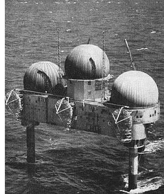 The prevailing opinion at the time was no, because the tornado itself is small in horizontal dimension. But these three severe weather events led to the formation of a Texas Tornado Warning Network in which communications between Weather Bureau offices and local public officials were established. Major cities in Texas were approached for funds (some from the private sector and some from the public sector) to modify and install radars in Weather Bureau offices. The Weather Bureau agreed to operate and maintain the radars and provide warnings to the public when confirmed sightings were made. Volunteer spotter networks were also established to supplement the radar installations. In some cases, a spotter would report a tornado before it was identified by radar, and sometimes identification was made from radar alone. (Image shows U.S. Air Force North American Air Defense Command "Texas Tower 2" radar station in 1956. Photo by the Department of Defense)
The Texas Agricultural and Mechanical (A&M) Research Foundation handled the funds, arranged for the radar modifications to be performed in the laboratories of the Texas A&M University Department of Electrical Engineering, and ensured that antenna towers were erected and cables installed in Weather Bureau offices. Formation of the network began at a kickoff meeting held on 24 June 1953 (Kahan 1953); approximately six years were required before the network attained full strength. About 17 radars were modified and installed under this joint effort by local government, state, and federal agencies, and a university.
The radar at Texas A&M University, although not formally a part of the Texas Tornado Warning Network, was used at least once for warning purposes (Bigler 1956). On 5 April 1956, a tornado that produced damage in Bryan and College Station, Texas, was detected by the Texas A&M radar. At noon that day, the Weather Bureau Forecast Center at Kansas City, Missouri, had issued what we would today call a tornado watch for an area just to the north of Bryan. The Texas A&M University radar observed strong, tall, hook shaped echoes with V-notch signatures after 1400 LT. At 1445 LT, Texas A&M University meteorologists called the Bryan Police Department and forecast that a tornado would touch down 30 min. later. Actual damage started at 1509 LT.
Texas A&M University also warned the College Station Consolidated School System, which decided to keep the children in their school buildings instead of releasing them at the scheduled time of 1500 LT. This is probably the first warning based solely on interpretation of radar data and is a good example of effective interaction between warning meteorologists and the local community. Today, with improved warning dissemination methods, increased community preparedness, and better radar capabilities and coverage, it is unlikely that a research team would be issuing warnings to communities directly.
Radar continues to save lives and increase warning capability everyday. Stay tuned for more weather radar history in part II.
This has been adapted and edited specifically for the AMS Weather Band from an original article by Roger C. Whiton, Paul L. Smith, Stuart G. Bigler, Kenneth E. Wilk, and Albert C. Harbuck. Any errors or omissions may be attributed to AMS Staff. Copyright remains with the AMS.
