July 8, 2020 EF4 Tornado Story
- By Brad Nelson
- Feb 13, 2023
Tornado
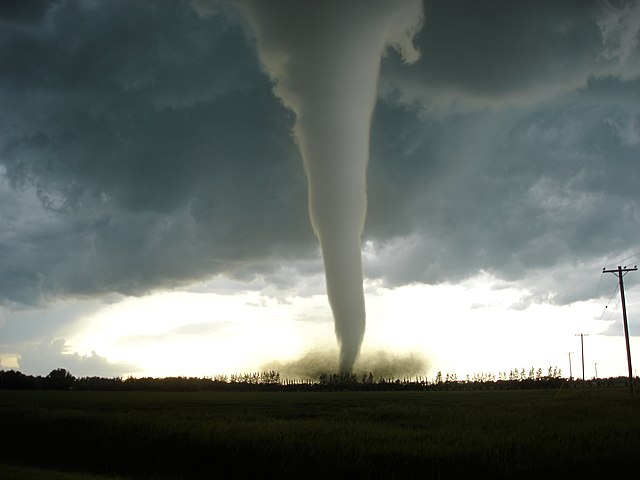
Gazing at this photo and where I was in this moment, I’m thinking “Is this real?”, “How did this happen?”, and “What got me here in this moment in time?”. My name is Brad Nelson and I am a meteorologist with 18 years of experience with the world’s largest private sector weather company DTN (www.dtn.com). I have been chasing storms regularly since 2007.
I decided to storm chase this day after looking at the forecast and consulting with my good friend, Melanie Metz. It was not a big outbreak kind of day and there was some indecision on even chasing storms due to the cap that was in place and with the subtle nature of the forcing due to a shortwave passing through the area. The warm front looked like the place to be, reinforced by an outflow boundary from morning storms. Melanie and I left the Twin Cities around 11 a.m. and initially targeted the area near Staples, Minnesota. After progressing north towards the target, we noticed that the triple point of the low-pressure center, warm front, and surface trough was to our west and the high-resolution guidance was now breaking out a few thunderstorms just ahead of this area. The decision was made to head west towards Fergus Falls, Minnesota to be closer to the low and where the storms were forecast to break out.
Upon reaching Fergus Falls and getting gas and lunch, we emerged 15 minutes later from the gas station and looked to the south to view an explosive updraft! We made our way towards the storm and almost immediately watched a wall cloud and funnel cloud develop. The storm was not warned so we called this into the National Weather Service, and it was quickly tornado warned shortly after our call. This is a testament to how important the ground truth information can be from storm spotters and chasers, especially in an area as this is in the middle of a gap in radar coverage.
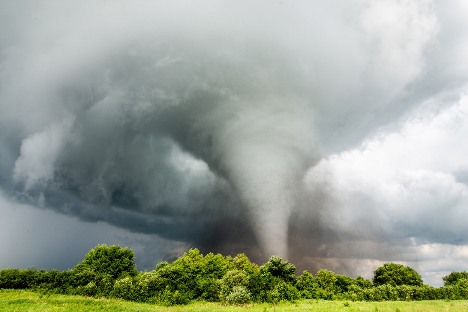
A short time later, the funnel cloud touched down and a tornado planted to the south of Highway 82. We progressed east on this highway to get closer to the developing tornado as it grew in size and intensity. Since the tornado was moving slowly and did not have any precipitation around it, we were able to drive right up to it, getting as close as 0.11 miles as it reached maximum EF-4 intensity and estimated winds of 170 mph! Unfortunately, the tornado hit a machine shop as we were in this position just to the southwest of the tornado and led to the death of 30-year-old Seth Nelson. There was a lot of debris around the tornado as it hit the structure. We were able to get out of our vehicle to gasp in awe of what was occurring, while the sun was shining on us, and we could hear the roar of the tornado. It is interesting that we could actually smell the tornado, a damp, musty smell that was clearly evident as the tornado slowly churned just to our north.
This was an incredible experience that I will never forget. It was my 100th tornado that I have seen and one of the most intense experiences of my life. My prayers go out to Seth Nelson who lost his life due to this tornado. This tornado is a stark reminder that we all need to respect the power of nature and the dire consequences that can occur with something that may seem so beautiful and powerful in the moment. A crazy fact was that the tornado occurred outside of any tornado probabilities on the Storm Prediction Center Outlook, not even in a 2%. It is important to stay weather aware of severe thunderstorm days, even when it may seem like the potential is rather low. If you want to see more of my photos, videos, and chase logs, feel free to visit my website at www.eyeonthetwister.com.