High Plains Drifter – The Nebraska Tornadoes of May 17th, 2019
- By Jessica Moore
- Aug 24, 2023
On the morning of May 17th, 2019, a somewhat uncommon bimodal severe weather setup was in place across the Central and Southern Plains. The Storm Prediction Center issued Enhanced Risks for severe weather for portions of western Texas as well as central Nebraska, with a 10% hatched tornado risk centered across central Nebraska and a 5% tornado risk for southwest Texas. Having forecasted for several days leading up to the event, my eyes had long been focused on the Nebraskan border with northwest Kansas near the town of McCook.
A deepening cyclone was progressing across northeast Colorado toward western Nebraska and northwest Kansas where a triple point, or intersection between differing air masses, was being established. Strong convergence, increasing moisture, and ample instability on the order of 2000 to 3000 J/kg combined to yield a potent severe weather setup. Large to very large hail, damaging winds, and a couple of tornadoes (with the potential for strong tornadoes) would all be possible across both the Central and Southern Plains.
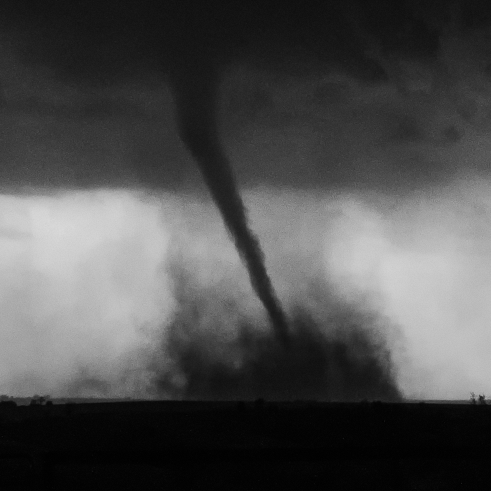
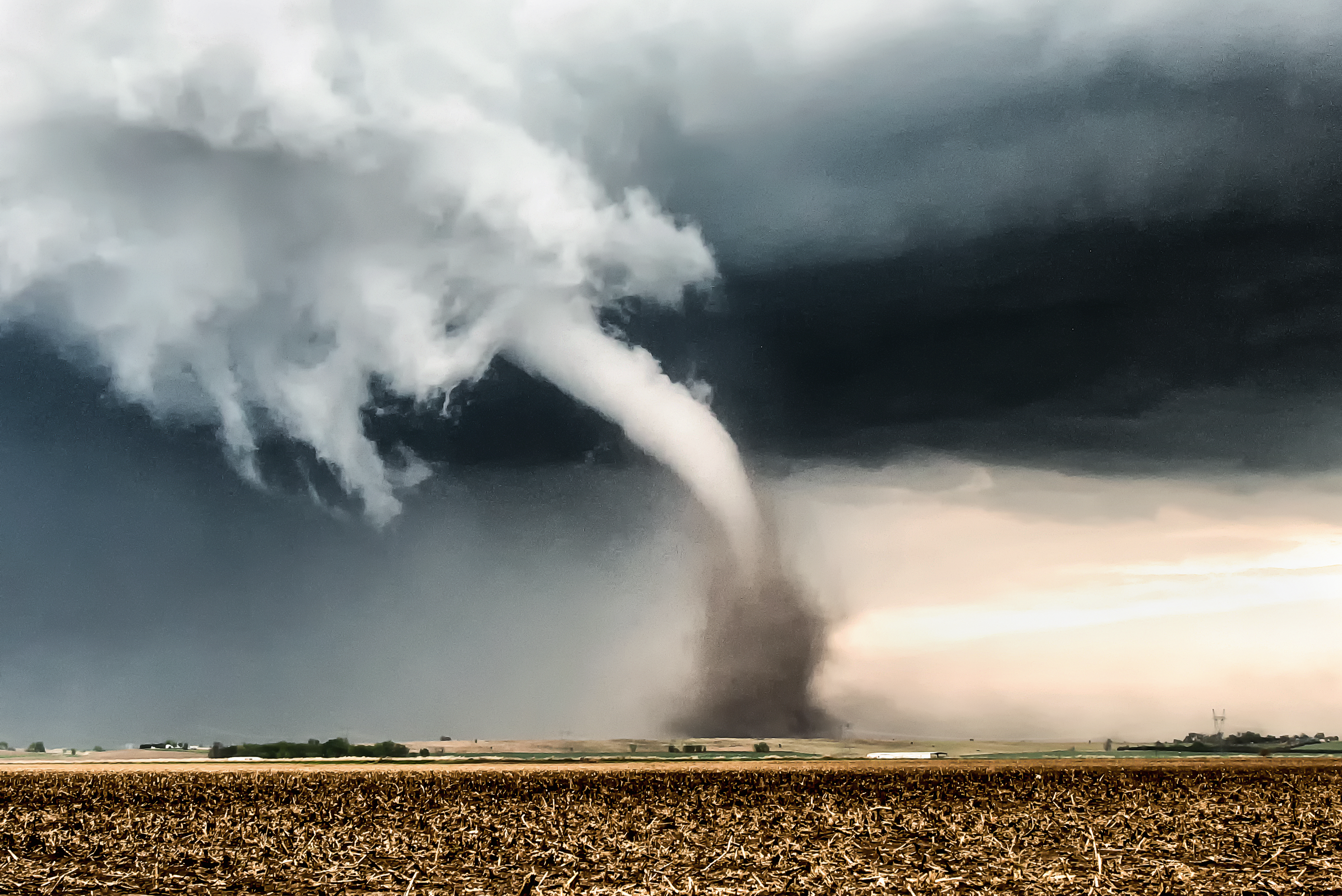
As convergence and low-level flow began to increase during the lunch hour, I positioned southwest of McCook and watched towering cumulus develop to my south and southwest in tandem with the approaching dryline and triple point. I watched as a strong cell began to exhibit signs of mid-level rotation along with a developing wall cloud. Before long it produced a brilliant white funnel that swirled and stretched slowly, elegantly toward the surface where it began to kick up dirt and debris. It then fully condensed into this picture-perfect white elephant trunk tornado just to my northeast just before 6:00 PM CDT. It was a mesmerizing scene to behold as I leapt from my vehicle and raced across the field to capture several images of the tornado.
“Helicity” by Jessica Moore – May 17th, 2019
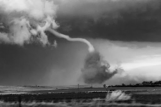
This picturesque tornado was on the ground for just over five minutes before dissipating. It was later rated EF-2 for causing some significant structural damage to a home, along with several farm outbuildings and multiple grain bins. Thankfully, there were no reported injuries or deaths resulting from this tornado. I took some artistic liberty with this film-like edit of the rope-out stage of the tornado below. It was a difficult shot to take out of the passenger side of a moving vehicle and as a result, there was some unwanted motion blur and grain in the RAW image. But I do love film images and thought this edit suited the scene so that I could still preserve the moment.
A few subsequent tornadoes occurred as the evening progressed. While these later tornadoes may not have been as photogenic as the first tornado near McCook, they were no less mesmerizing and exciting to witness. This ominous Wizard of Oz-like tornado was documented near the rural town of Farnam, Nebraska just after 7:00 PM CDT. It progressed for nearly 20 minutes before dissipating and was later rated EF-1. Again, thankfully, no injuries or deaths resulted from this tornado.
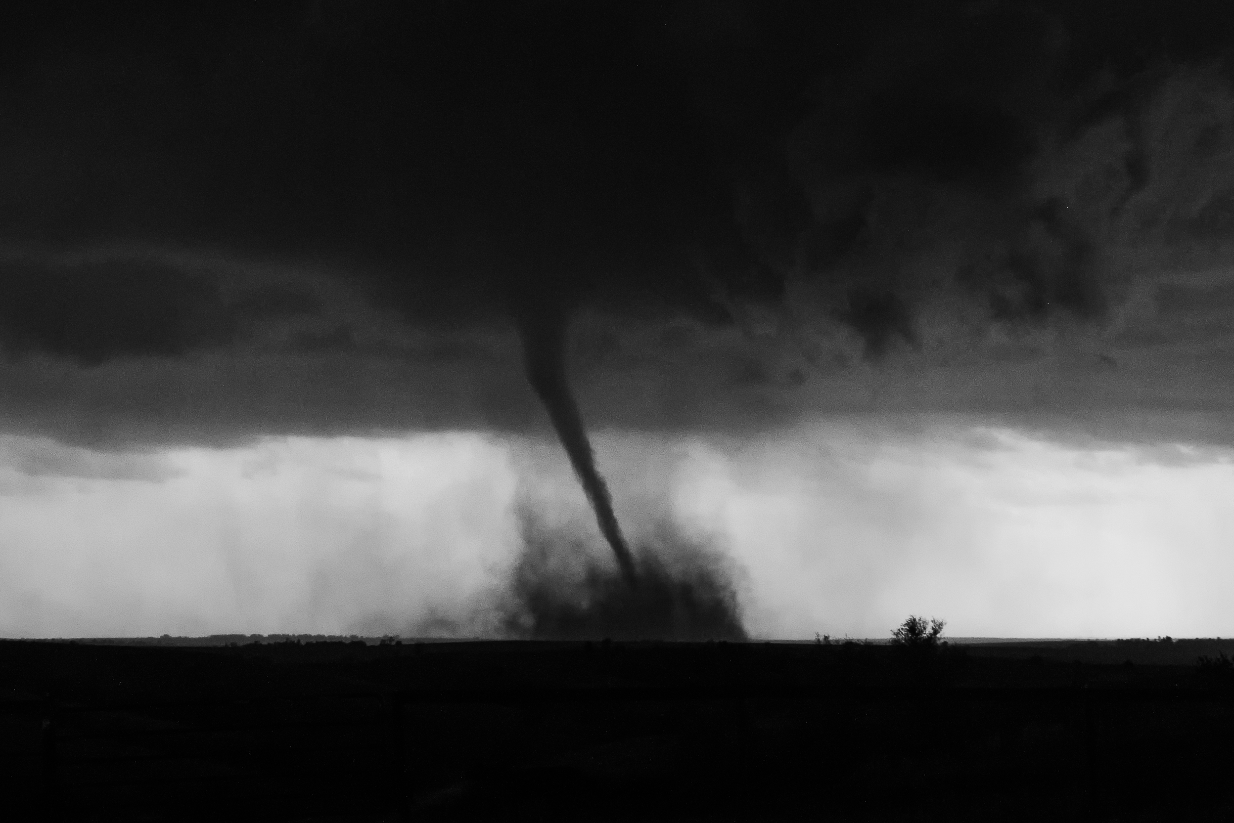
“Land of Oz” by Jessica Moore
Unfortunately, after this tornado was documented, I encountered some challenges navigating the sparse road network and fell behind the storm just as it was producing a much larger tornado near Cozad. This tornado was the least photogenic of the handful of tornadoes that occurred in the region that afternoon, so I was still content with the overall success of the chase, especially after witnessing the incredible McCook beauty.
I have a certain infatuation with white tornadoes, as they are so misleading in their elegance and beauty. At times it is hard to believe that such a beautiful force of nature can also be so destructive. Thus, I maintain an unwavering commitment to reporting severe weather hazards to the National Weather Service via Spotter Network and through my various social media platforms so long as it is safe for me to do so.
While storm photography is my lifeblood and my calling, I endeavor to always do my part to help relay critical weather hazard information to the public with the intention of helping people know when to seek safety and shelter. In this way, I can fulfill my artistic passion while contributing to science and public safety communications simultaneously. Both endeavors have their purpose and significance.
Bio:
I am a meteorologist, travel writer, and professional photographer in Colorado where I was born and raised. The dramatic weather extremes that I experienced growing up sparked my fascination with the atmosphere, which led to my pursuing meteorology at Mississippi State University and graduating from their Broadcast and Operational Meteorology program in 2020. I have also simultaneously been chasing and photographing storms for the last 12 years, and feel a calling to capture the rarest, most beautiful, and most powerful storms on the planet so that I can share those moments with the world. My artistic mission is to show the beauty in the storms that so many fear, in the hopes that by doing so, it can offer another perspective that garners a sense of awe and wonder for the skies above.
My images and videos have been sought after by commercial clients across the world, and have also been aired on most national networks in the U.S. I’ve been fortunate to have many opportunities to showcase my storm images in prestigious art exhibitions around the world as well, including Art Basel in Miami, among others. I’m grateful for any opportunity to share my art – and the beauty of our atmosphere – with the world.