Creating a Forecast for Your Location: Procedure and Analysis for the Amateur Weather Enthusiast
- cruising
- By Ben May, Board Director of the National Weather Association Foundation
- May 31, 2021
I am approaching this particular blog post with a bit of consternation and reservation. Most of us are so enthralled by the progression of daily weather that we become amateur weather observers. After some time recording our observations, many of us scratch that itch to stick our necks out to make a forecast for our location.
Come on, admit it: don’t you have some pride when your friends and family admire you for the one out of 100 correct forecast you make? I love letting my adult son and his family in Decatur, Georgia become aware when severe storms are approaching and what to expect by the minute. Just the other day my granddaughter asked my son: “Is pappy a weatherman?” Now that was an honor for sure! No, just a weather geek.
While I have some years of experience as a Cooperative Weather Observer with NWS and an Advanced Skywarn Storm Spotter, I am just an amateur with emphasis on the words just and amateur.
Giving guidance to others about forecasting is certainly the domain of professional meteorologists. In fact, everything I’ve learned besides my own experience and study has come from asking my meteorologist friends for guidance and advice, sometimes driving them nuts in the process! In fact, most of my experience comes from the regime guidance I received from local NWS meteorologists. So, with these rigid qualifications in mind, I’m going to outline my own approach for making a local forecast.
You might even ask: “Why do I need to make a forecast? Can’t I just take observations and leave it at that? Certainly. A good portion of this blog will be dedicated to getting the correct observations. If you do want to make a precise forecast, you need to have the best data available. This means having good instruments mounted in the right place. We will do another blog post later dedicated to instruments. However, if you have a computer and/or mobile device you don’t even need instruments. You can plug into a local instrument online through a Weather Underground observer nearest your location. Aside from that, you have the power of your own observations of the sky. Remember we are observers first. What do we see, feel and hear? Some things don’t change even in our ‘modern’ age.
What’s My Purpose?
The most important purpose in making a good forecast attempt, in my opinion, is to learn something, not necessarily just to say you got it right. Every time you don’t get it right, you learn how to get it better so you can then get it right. One of the challenges is that there is so much information available that you can literally go nuts from overload. So, one rule is to stay focused. Also, consider if this is a daily forecast or something special such as the approach of severe storms in your area. These are obviously different kinds of forecasts. I am focusing on the daily forecast with a bit of a view to severe weather only as it might affect the daily forecast.
Where Do I Start?
Sometimes I like to think about forecasting as a kind of artistic endeavor grounded in rigorous logic, a bit like non-metric geometry or sculpting if that makes any sense. I use the mantra: Observe-Create-Confirm. See what the weather situation is first around the world, country, then in my region, state, city and location Then I look at measurements locally. Once I have all of the possible ‘ingredients’ gathered together, I go to forecast creation. As I am looking at the progression of the weather geographically, I try to visualize what the graphic representation would be on a weather map at the surface. *I try to see how the flow and swirls of water vapor that could indicate low pressure systems, with extending cold and warm fronts. I envision rising and lowering isobars of pressure and, finally, wind patterns- direction and speed at different pressure levels or heights in the atmosphere.
Start Globally to Forecast Locally
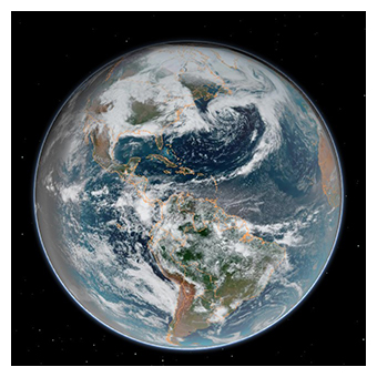 Most of my meteorologist friends advise me to start globally to forecast locally. In my opinion, the best way to learn is to see the progression of weather across the country first. If you really want to get a broad panorama you can take just a few minutes for a global view. The most important point here is to get accustomed to thinking of the weather as an ocean of air composed of a number of different levels, with waves and eddies swirling around each other, moving at different speeds from West to East.
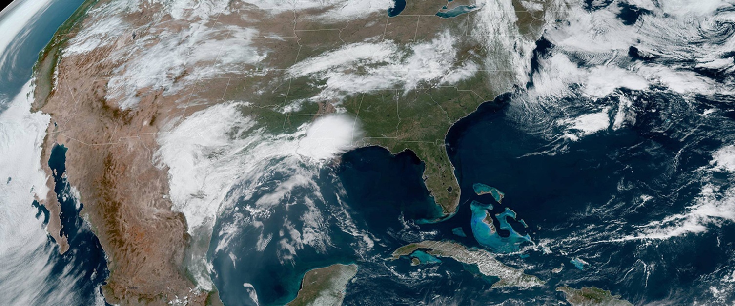
One excellent site for global views is: NOAA's NESDIS: National Environmental Satellite, Data and Information Service. This is the ‘blue marble’ view of the planet (as seen above) which one can manipulate to view the global weather progression. There are also tighter, excellent views of US and regional weather. These views include cloud cover progression as well as infrared and water vapor. I spend a lot of time viewing water vapor at different levels from national to my location as this is the actual physical movement of the atmosphere. In my opinion it’s one of the best products to really understand weather visually in three dimensions.
So, the next product I view is also satellite: GOES East. It’s a variation of the previous view but a bit more in-depth. I can go to it directly. This view can be found on the Penn State ‘E-Wall Electronic Wall Map.’ This is an amazing in-depth wealth of information in one place. There is literally every kind of data one could ever need, including numerical models and satellite pictures.
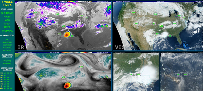
Views of GOES-East from Penn States' E-Wall
My next stop is one of my favorites. If there is just one website for forecasting, this is the one: College of DuPage (COD): Next Generation Weather Lab. On that site I then go to Weather Analysis Tools/Satellite and Radar. If you only use one product to make your prediction, use this one! The views go from global to local with sixteen different parameters and eight different color products to see through the atmosphere. There are 18 product overlays including composite radar to cloud top height to a few severe weather parameters such as CAPE and Supercell Composite. This entire panorama can then be animated at different speeds.
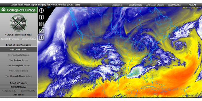
College of DuPage satellite views. This map shows low level water vapor. Courtesy of College of DuPage
Mapping
Next, I start to think about mapping. There are a few options here. You can just stay with COD. Under Weather Analysis Tools, go to Analysis Products > Upper Air Maps Main/RAP Mesoanalysis. There are ten different maps from water vapor and vorticity (spin in the atmosphere) at 500 mb (18k’) to 700 mb (10k’) humidity. I go to the 300 or 200 mb jet stream first because this parameter influences our weather so much depending on the season.
Then I look at the 500 mb vorticity chart because this parameter gives me an idea of the progression of low pressure or short waves indicating possible storms.
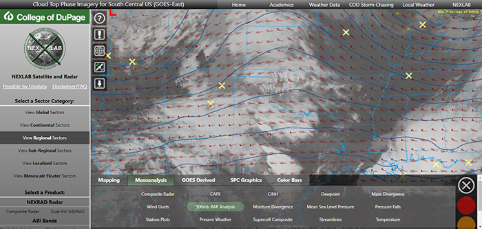
College of DuPage 500 mb RAP Analysis. Courtesy of College of DuPage
Synoptic Maps
I review two kinds of map sites. First, the SPC Mesoscale Analysis Page. This is from NOAA's Storm Prediction Center. While the purpose of this site is predominately for severe weather, there are tools on the site that can be used for one’s own local forecast. This map includes 21 different parameters that I can manipulate to create my own kind of a synoptic map. This gives me a feel for my forecast. The map is shown nationally, but one can dive into 10 different regions for your own area.
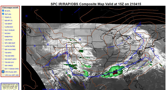
SPC Mesoscale Analysis. Courtesy of NOAA
Next, I go to NOAA's Ocean Prediction Center Unified Surface Analysis. This is an amazing site of synoptic maps that really give one an idea of the weather’s progression from a very broad analysis.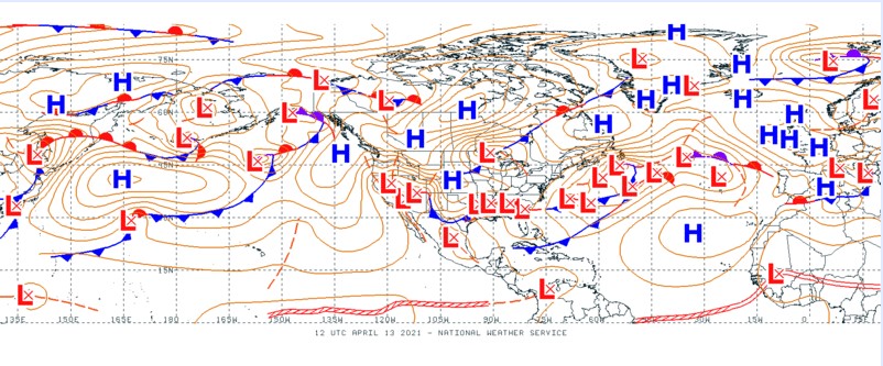
Unified Surface Analysis. Courtesy of NOAA
Next, I go to NWS Forecast Maps. I look at the national synoptic (surface) map in detail. I also look at the three- and seven -day animated forecasts that are driven numerically. Now, there is a bit of overlap so one does not need to go to all of these maps.
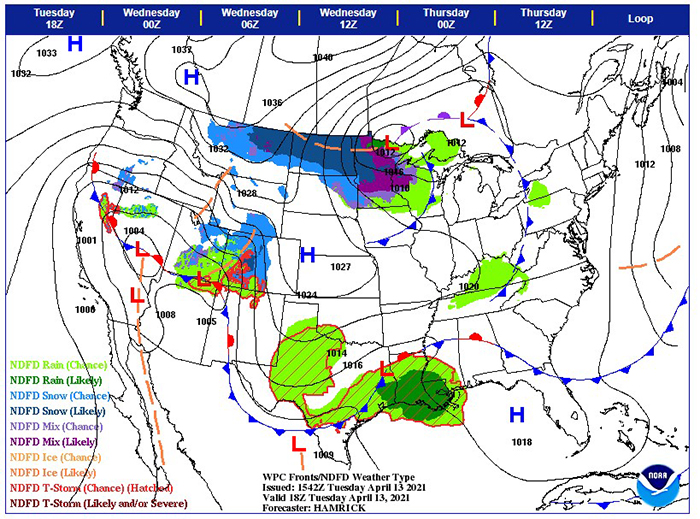
NWS Forecast Map. Courtesy of NOAA
Local Observations and Forecast
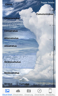 Finally, I go to my local area, reviewing my own instrument observations at 7AM for input to NWS office as a Cooperative Observer (I use two: Davis Vantage Vue and a totally digital one: WeatherFlow Tempest), I take a good look at the ceiling (I get this from Accuweather) and cloud progression. As I look at the clouds, I refer to my Cloudy Sky app on my mobile device. This is important. The type of clouds and progression of the cloud layers are excellent indicators of weather I can expect, especially if different cloud types are moving at different height levels. In fact, a detailed reading of the clouds, a barometer, thermometer, hygrometer and anemometer/wind vane are all you need for an immediate forecast if you don’t have any online access. It can be that easy! This is how it was done for many, many years.
Create the Forecast
Then I am ready to make a forecast. Sometimes I will use Tim Vasquez’s Digital Atmosphere 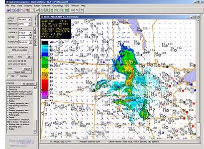 to create my own national map (see my previous blog posts on websites). As a final check I go to the local Wx office scientific forecast discussion on my Deep Weather application (see previous blog on apps). I only look at this after I make my forecast to see how close I came to the experts’ prediction.
The Role of Numerical Forecasts
I do use the numerical forecasts but mostly to review upper -level movements (wind and pressure heights) at different pressure levels from 200-300 mb to 500 mb, 700mb and 800 mb. I try to keep away from using a numerical model except to confirm my own prediction.
Severe Weather, Instability and Rules of Thumb
Growing up in Oklahoma, loving the severe storm season hooked me on meteorology. Now living in Central Florida, it's not as ‘dynamic’ as Oklahoma, but I do enjoy our storm season from May through early September. Sometimes we can experience strong to severe thunderstorms. Hurricanes are a different ‘animal.’ I’ll leave that one to others more qualified to discuss. During the storm or “rainy’ season” I go to the Storm Prediction Center Page, accessing Forecast Tools. There I review the Skew T and Hodograph charts for my location. 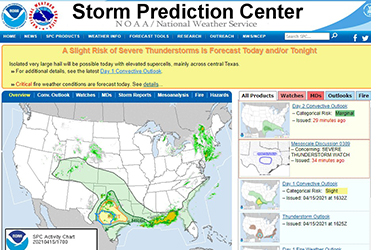
During the storm season I must admit that sometimes I cheat a bit. Right after I wake-up I go directly to the Skew T and Hodograph because it's exciting when the parameters for severe storms are prevalent. After a few years I am still learning about these two critical charts. They are essential, in my opinion, to learning about the weather for your location. Each chart deserves a course in itself, and there are plenty of resources one can access. In fact, there is a symbol-oriented tutorial on the website. The NWS Skew Ts are available 2-3 times a day. However, Pivotal Weather has immediate 24- hour access to the Skew T at any location from each numerical model except the European. You just select your location. I could also do a separate blog just on severe weather parameters. But these rules of thumb/ mathematical derivatives can be found at the Weather Prediction or NWS Explanation of SPC Severe Weather Parameters.
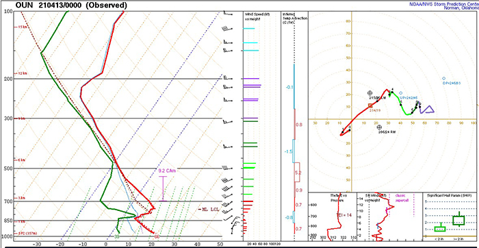
Skew T chart. Courtesy of NOAA
Once I review the Skew T and Hodograph I add in my ideas about thunderstorms. Typically, we get sea-breeze storms by late afternoon. Sometimes, a strong cold front or frontal low will dip southerly enough to interact with a sea-breeze front, creating excessive instability and possible supercells.
What’s Your Region’s Tendency?
I’m including this mention because it does have a small influence on my forecasts. I use the word tendency as it relates to the climate in your area, and, specifically, to the dominant air mass. Here is an example of what I mean. I have lived in Oklahoma City, Washington DC, Seattle, Tampa and Orlando Florida, and Paris, France. Each city, and region for hundreds of miles around, is dominated by a particular air mass (the study of air masses is a part of elementary meteorology and too long to discuss here). Here is an example of what I mean. Seattle and the Pacific NW Coast are influenced by a dominant polar maritime air mass and the semi-permanent Aleutian Low with short waves and fronts breaking off, bringing rain, cloudy skies and cool temperatures nine months of the year. The Cascade Mountains keep the rain and clouds over the western portion of the state. Even when the sun breaks through from time to time, the tendency is cloudiness with rain. In Orlando in Central Florida (all of Florida), tropical maritime air mass and the Bermuda High predominate so the tendency is humid air with clouds clearing away quickly. I keep these tendencies in mind when I finish my forecast.
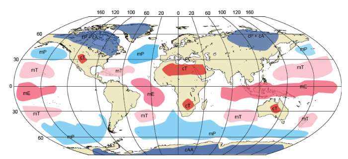 Global air masses. Courtesy of NASA
Practice, Practice, Practice
Like anything worth doing, one just has to practice, make mistakes and correct. One of the reasons I have always loved meteorology is that I had this psychological quirk since I was a child that I would become bored with life. Observing the dynamism of weather makes boredom impossible. At least, so far at 70 years old, I'm still not bored.
Good luck with your forecast!
* A quick point of information: meteorologists refer to any graphic like a map, chart; any kind of measurement presentation or numerical model as a product.
