Accounting for Lakes
- By AMS Staff
- Dec 6, 2022
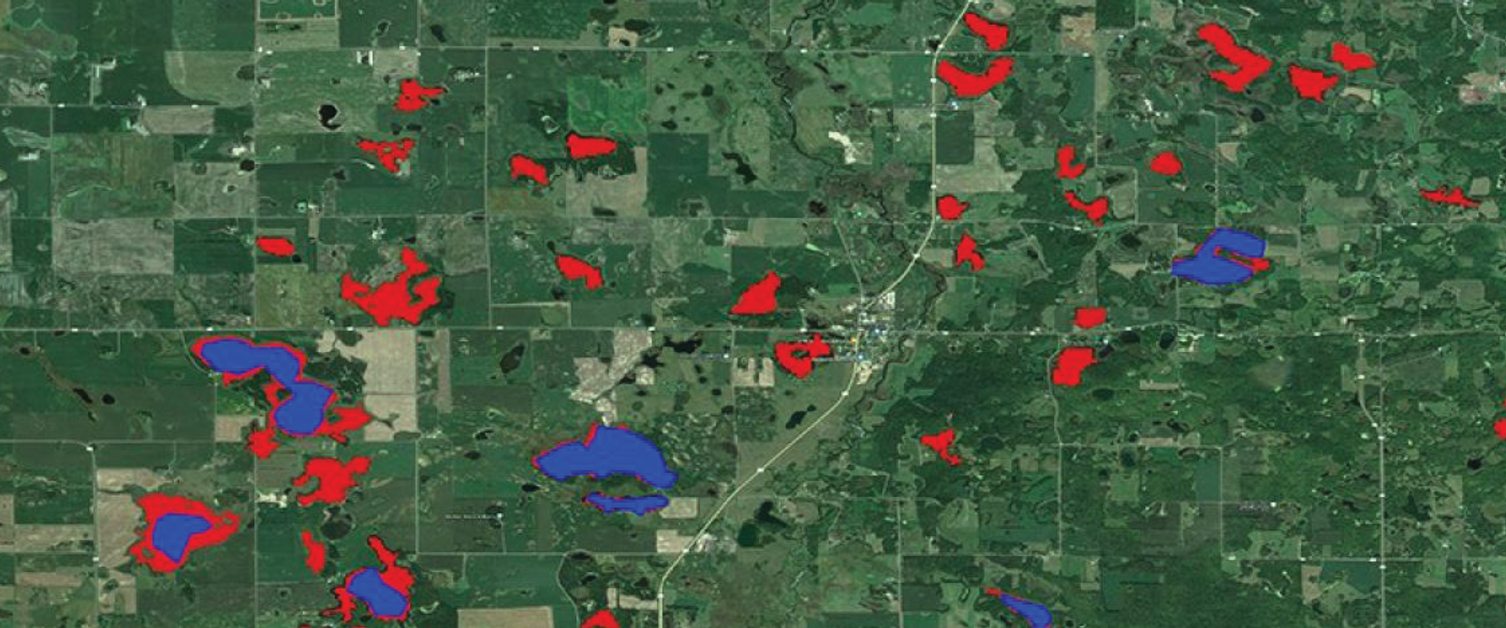
FIGURE CAPTION: An image of Minnesota lakes identified using the ReaLSAT dataset (red) is blended with a similar image of the area with lakes identified using the older HydroLAKES dataset (blue). [Image credit: ReaLSAT, University of Minnesota]
681,137—The number of lakes and reservoirs throughout the world identified in a new database called the Reservoir and Lake Surface Area Timeseries, or ReaLSAT. The new dataset, which includes bodies of water larger than 0.1 square kilometers that are located south of 50°N, contains almost three times more lakes and reservoirs than the previous largest such database (known as HydroLAKES). By including monthly surface area information for each body of water for the years 1984–2015, ReaLSAT shows how the lakes and reservoirs have changed over time, which will aid the study of how a changing climate is impacting bodies of fresh water. “Around the world, we are seeing lakes and reservoirs changing rapidly with seasonal precipitation patterns, long-term changes in climate, and human management decisions,” notes Vipin Kumar, of the University of Minnesota, who coauthored a study on ReaLSAT. “This new dataset greatly improves the ability of scientists to understand the impact of changing climate and human actions on our fresh water across the globe.” ReaLSAT utilizes machine learning algorithms that combine the physical dynamics of bodies of water with satellite imagery. The dataset can be extended nearly automatically and can also be replicated for other Earth observation data. “Because ReaLSAT shows changes in lakes and their boundaries, rather than just water pixels across the landscape, we can now connect ecosystem process[es] about water quality with hundreds of thousands of lakes around the world,” says coauthor Paul C. Hanson of the University of Wisconsin—Madison. The study was published in Scientific Data. [Source: University of Minnesota]
* For more content from the Bulletin of the American Meteorological Society, please visit bit.ly/AMSBAMS
