These Data Are for the Birds
- By AMS Staff
- Mar 6, 2024
Bird photo credit: iStock.com/guenterguni
PROBLEM: As the lowest layer of the troposphere, the planetary boundary layer (PBL) connects the atmosphere to Earth’s surface and significantly influences weather and climate, which means “understanding PBL dynamics is fundamental to answering a lot of questions about the Earth system,” notes Ian Brosnan of NASA’s Ames Research Center. The thickness of the PBL varies depending on wind speed and temperature, and the layer can extend as high as 2.5 miles above Earth’s surface. Measurements of the PBL are typically taken from the ground or with remote sensing over ocean regions, and as a result, “getting in situ samples of any sort at scale is a challenge,” Brosnan says.
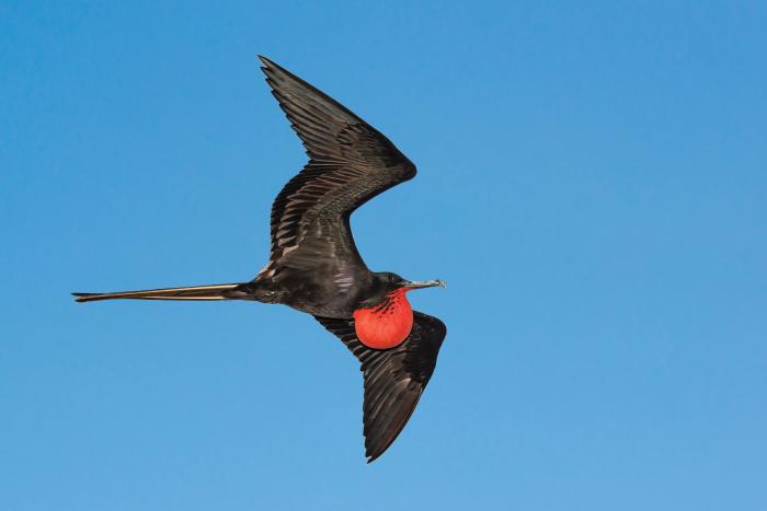
SOLUTION: Brosnan led recent research based on a 2006–19 analysis of the PBL in which small sensors were attached to great frigatebirds to assess the boundaries of a protected marine area in the Pacific Ocean. Frigatebirds regularly fly at altitudes of more than a mile and sometimes reach heights of more than two miles. Brosnan theorized that the birds “could be traveling to the top of the PBL, turning around, and coming back down.” He and colleagues reviewed the data from that analysis, comparing the birds’ flights to PBL measurements, and found that the birds’ altitudes were very similar to the long-term average PBL heights, indicating that the frigatebirds could be valuable collectors of PBL data; in fact, they had collected the PBL temperature profiles in the analysis Brosnan and his colleagues examined. And unlike commonly used measuring techniques, the birds can collect data in cloudy weather and at nighttime.
![Sensor photo caption: A sensor attached to the tail feathers of a great frigatebird. [Photo Credit: Abram Fleishman]](/weatherband/assets/Image/parcels_data_for_the_birds_sensor.png)
A sensor attached to the tail feathers of a great frigatebird.
[Photo Credit: Abram Fleishman]
“These novel approaches to using animal tracking data can help NASA measure the planetary boundary layer and improve climate predictions and weather and air quality forecasts,” Brosnan says. NASA recently created the “Internet of Animals” project to combine remote sensing measurements with data collected by animals, including the PBL data collected by frigatebirds. Brosnan’s research was presented at the recent American Geophysical Union Annual Meeting. [Source: American Geophysical Union]
* For more content from the Bulletin of the American Meteorological Society, please click here.