Like Photoshop For Satellites
- By AMS Staff
- Jul 7, 2024
PROBLEM: Satellites collect a wealth of information about Earth, but data they collect about the planet’s water bodies either have high spatial detail with just occasional updates or lower spatial detail with more frequent updates, forcing scientists to choose between accuracy and frequency. Data fusion, which combines data snapshots from multiple sources, is used as a workaround but is limited by sensitivity to atmospheric disturbances and other climatic factors that can result in noise, outliers, and missing data.
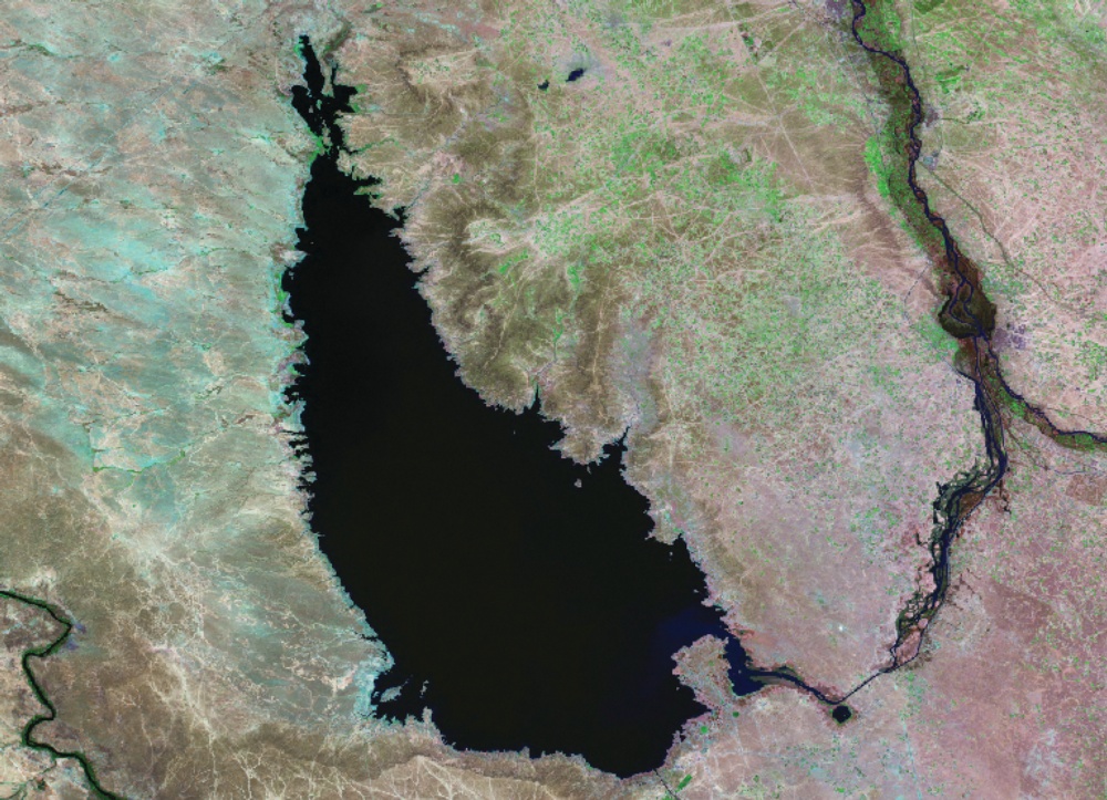
SOLUTION: Researchers have developed a new tool called the Hydrological Generative Adversarial Network (Hydro-GAN), a machine learning–based method that maps available low-resolution satellite data to a high-resolution data counterpart. Using Hydro-GAN, the researchers were able to integrate low-resolution data from the Terra satellite and high-resolution images from the Landsat 8 satellite. They looked at Iraq’s Lake Tharthar as a case study, utilizing image data for the years 2015–21 of 20 such reservoirs in the United States, Australia, Mexico, Iraq, and other countries. “Using seven years of data from MODIS and Landsat 8, we evaluated our proposed Hydro-GAN model on Lake Tharthar’s shrinking and expansion behaviors,” explains coauthor Pouya Hosseinzadeh, a doctoral student at Utah State University. “Using Hydro-GAN, we were able to improve our predictions about the lake’s changing area.” Hydro-GAN’s capability to generate high-resolution data at historical time steps is unprecedented, and the method should prove valuable for hydrologists, water managers, and environmental scientists where an abundance of historical data is needed for accurate forecasting. Hosseinzadeh says the scientists plan to move forward with similar models that employ a “multimodal approach to provide data in addition to images, including information about topology, snow data amounts, streamflow, precipitation, temperature, and other climate variables.” The new method was discussed recently in Water Resources Research. [Source: Utah State University]
CAPTION: Image of Lake Tharthar taken in 1990 by Landsat 5. [Credit: NASA]