A Classic MCS
- By Ted Best
- Jun 17, 2024

Ted Best
Weather Band Solos
To help AMS Members share their Weather Band contributions, we have created our community of "Soloists". In "Solos", our Members have the stage to showcase their unique weather insights. It's a chance for someone from the Band to have a moment in the spotlight to share their personal perspectives and insights, which adds more voices to our diverse community.
If you have awakened in the middle of the night to the sound of thunder and heavy rain, chances are, you have experienced a Mesoscale Convective System (MCS), or perhaps it’s larger sibling, the Mesoscale Convective Complex (MCC.) A study by Fritsch et al 1986, showed MCSs contributed 30-70% of the warm season precipitation across parts of the Midwest and plains states in 1982. As such, they make an important contribution to agriculture, not to mention their effect on large scale atmospheric circulations (Stensrud, 1996.) Using modern remote sensing tools and some good old fashioned ground truth observations, we can easily form an accurate picture of these weather systems and their impacts.
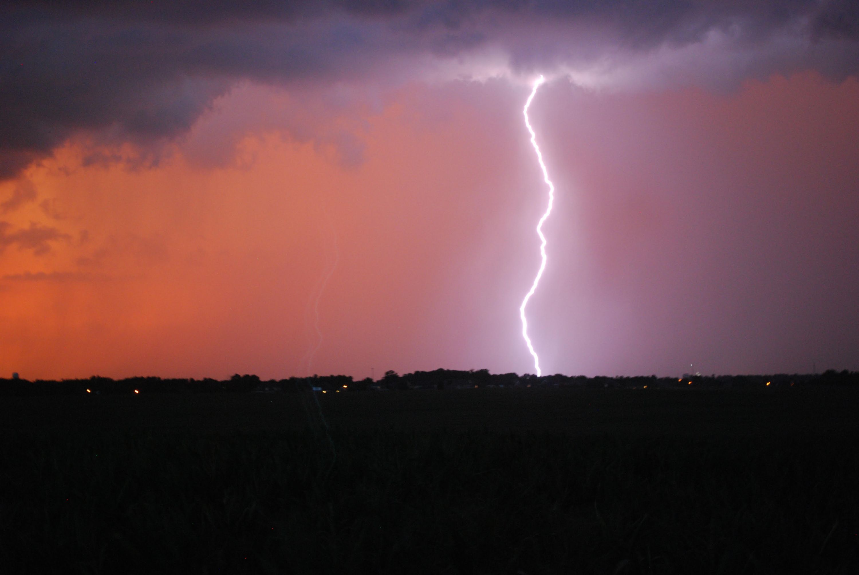
A classic example of an MCS (or MCC by the Maddox 1980 definition) occurred recently in the overnight hours between Saturday, June 8 and Sunday, June 9, 2024.
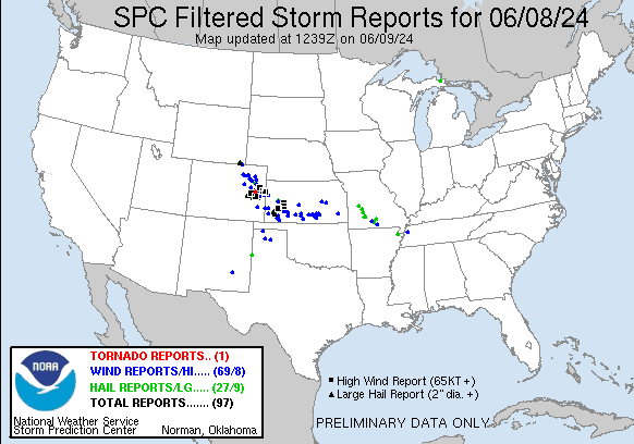
This event produced a number of wind reports across Colorado and Kansas. Early in the event, at 0053 UTC, prior to MCS organization, an ASOS station near Burlington, CO recorded a 97 mph wind gust. As the MCS matured, the event transitioned from a wind-producer to a heavy rainmaker.
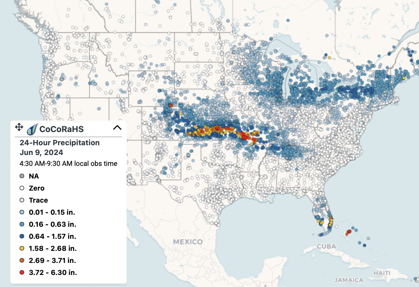
The precipitation across Kansas from this event was quite impressive with many reports in excess of 2 inches and some well over 3 inches.
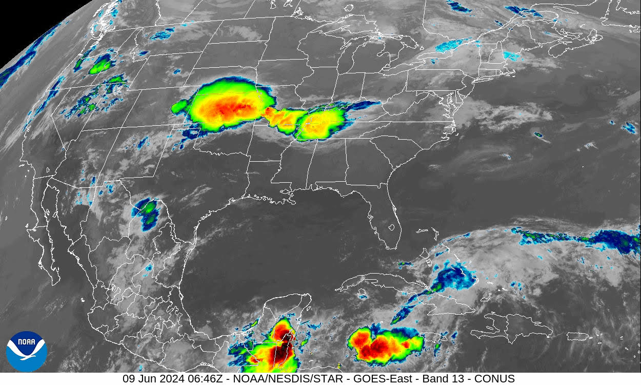
This MCS was very recognizable on satellite and radar. The enormous cold cloud shield can be seen on this 10.3-micron IR image. The yellow and red areas represent temperatures less than -59°C. This image was taken at 0646 UTC 09 June.
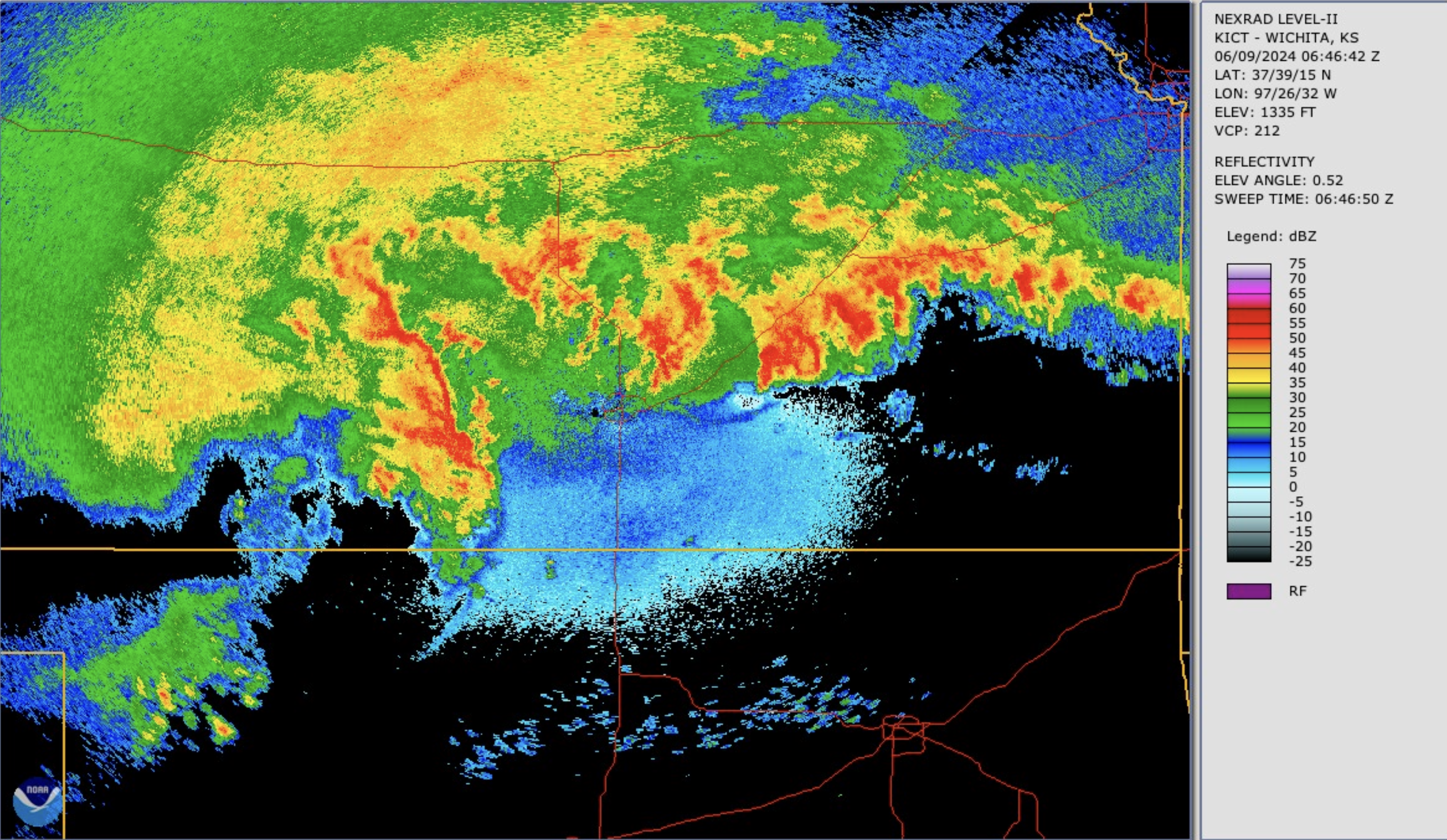
The corresponding radar base reflectivity image for 0646 UTC 09 June shows the heavy precipitation associated with convective cells and a large area of stratiform precipitation on the west and northwest side of the MCS.
If you would like to learn more about these giant thunderstorm complexes, join us for our webinar, A Force To Be Reckoned With: How Large Storm Complexes Rock the Summertime Landscape. We’ll learn from the experts about the development and evolution of these storms, as well as what the future may hold.
Selected References (panelists in bold)
Adams-Selin, R. D., 2020: Sensitivity of MCS Low-Frequency Gravity Waves to Microphysical Variations. J. Atmos. Sci., 77, 3461–3477, https://doi.org/10.1175/JAS-D-19-0347.1.
Adams-Selin, R. D., and R. H. Johnson, 2010: Mesoscale Surface Pressure and Temperature Features Associated with Bow Echoes. Mon. Wea. Rev., 138, 212–227, https://doi.org/10.1175/2009MWR2892.1.
Coniglio, M. C., J. Y. Hwang, and D. J. Stensrud, 2010: Environmental Factors in the Upscale Growth and Longevity of MCSs Derived from Rapid Update Cycle Analyses. Mon. Wea. Rev., 138, 3514–3539, https://doi.org/10.1175/2010MWR3233.1.
Fritsch, J. M., R. J. Kane, and C. R. Chelius, 1986: The Contribution of Mesoscale Convective Weather Systems to the Warm-Season Precipitation in the United States. J. Appl. Meteor. Climatol., 25, 1333–1345, https://doi.org/10.1175/1520-0450(1986)025<1333:TCOMCW>2.0.CO;2.
Houze, R. A., 2018: 100 Years of Research on Mesoscale Convective Systems. Meteor. Monogr., 59, 17.1–17.54, https://doi.org/10.1175/AMSMONOGRAPHS-D-18-0001.1.
Houze Jr., R. A. (2014). Cloud Dynamics. Chapter 9: Mesoscale Convective Systems. Netherlands: Elsevier Science pp. 237-286.
Hu, H., L. R. Leung, and Z. Feng, 2020: Understanding the Distinct Impacts of MCS and Non-MCS Rainfall on the Surface Water Balance in the Central United States Using a Numerical Water-Tagging Technique. J. Hydrometeor., 21, 2343–2357, https://doi.org/10.1175/JHM-D-20-0081.1.
Maddox, 1980: Mesoscale Convective Complexes. Bull. Amer. Meteor. Soc., 61, 1374-1387.
Stensrud, D. J., 1996: Effects of Persistent, Midlatitude Mesoscale Regions of Convection on the Large-Scale Environment during the Warm Season. J. Atmos. Sci., 53, 3503–3527, https://doi.org/10.1175/1520-0469(1996)053<3503:EOPMMR>2.0.CO;2.
Yang, Q., L. R. Leung, Z. Feng, and X. Chen, 2023: Impact of Global Warming on U.S. Summertime Mesoscale Convective Systems: A Simple Lagrangian Parcel Model Perspective. J. Climate, 36, 4597–4618, https://doi.org/10.1175/JCLI-D-22-0291.1.